The Collector's Edition of issue one has landed

It's a bit later than anticipated but we're delighted to tell you the Collector's Edition of issue is one is back from the printers, smelling beautifully fresh and inky

The Collector’s Edition is on sale now

We'd like to say a big thank you to everyone who donated to our crowdfunding campaign and helped us send our Collector's Edition to print. The journal is freshly back from the printers and we're sending out copies to those of you who pledged for an issue or pre-ordered through our store page.

It’s been a real joy to revisit our first edition; to think back to the time and thought we put into crafting the Ernest voice, indulging our curiosity and allowing our contributors the space to share their stories.

We’ve had to carefully consider where to update features. Many of the independent brands have gone on to thrive, while others have closed or changed gear – bespoke bicycle makers have become flower growers – and so we often suggest alternatives or ways you can follow the makers in their new endeavours.

We have also added two new stories. ‘A Perfect Clutch’ explores the meticulous research that goes into crafting replica bird eggs, while in ‘Ernest in the wild’, we ask contributors to share memories of journeys undertaken for the journal, from breaking bread at a Greenlandic kaffemik to floating with jellyfish in the Salish Sea.

The sense of community that has grown around Ernest over the past eight years is remarkable, and we continue to feel buoyed by your support and encouragement. Thank you for being part of our journey! We're so excited to share our Collector's Edition with you – let’s take a look at what’s inside…

Inventory

Nautical slang, anatomy of a storm kettle, the Mechanical Turk, how to cook meat underground, the real Moby Dick, a map of shipping regions, summer cocktails and a timeline of forks.

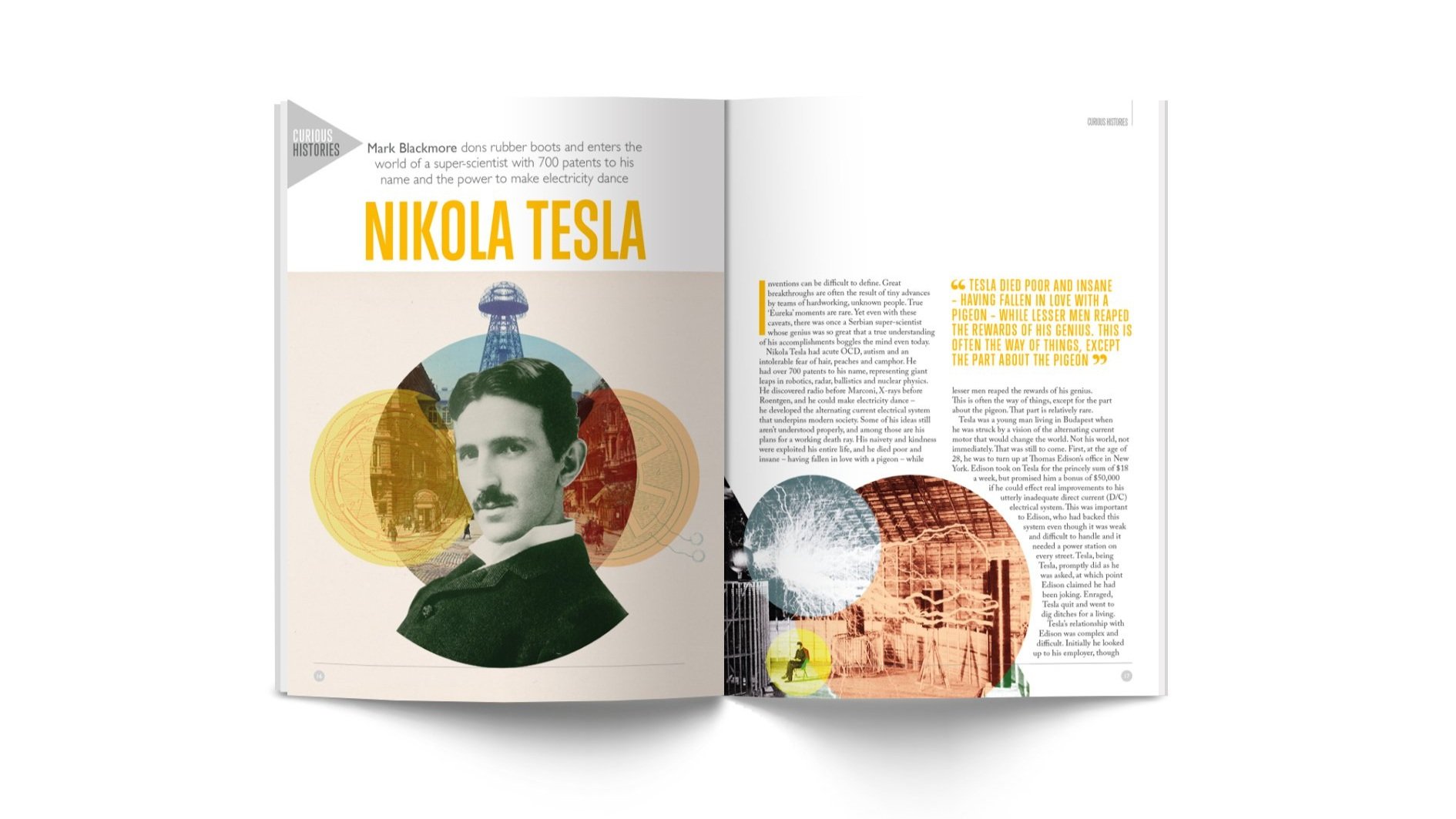
Nikola Tesla

Mark Blackmore dons rubber boots and enters the world of the Serbian super-scientist, with 700 patents to his name and the power to make electricity dance.

Ernest in the wild

To celebrate eight years of publishing Ernest, we asked contributors to share their memories of journeys undertaken for the journal, from breaking bread at a Greenlandic kaffemik to floating among thousands of jellyfish in the Salish Sea. 

Last & awl

Meet John Lobb, fourth generation crafter of bespoke shoes, guardian of Frank Sinatra’s wooden feet and boot maker to the future king.

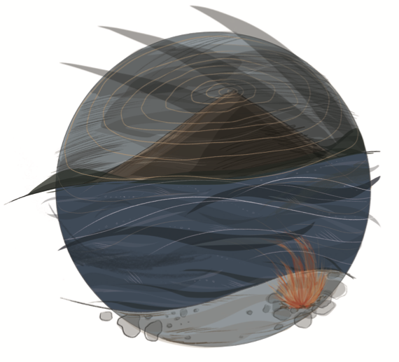
Sea monsters of the northern seas

Duncan Haskell wakens the mythical beasts that slumber beneath our oceans, including an island that drags sailors to a watery grave and a creature that collects human bones in his beard.

A perfect clutch

Editor Jo Tinsley enters the studio of Tony Ladd to explore the research that goes into crafting replica bird eggs.

The Westfjords Watertrail

Follow a trail of thermal pools in the Westfjords – an ingenious project dreamt up by architects and philosophers – focusing on the repurposing local materials, supporting communities and embracing Iceland’s natural resources.

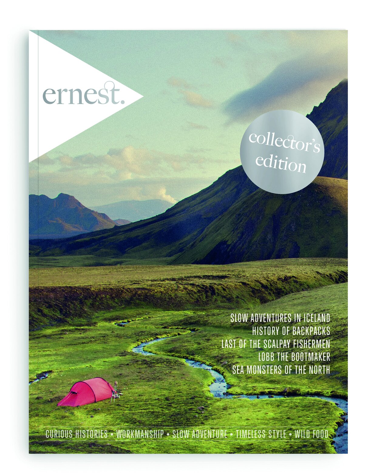
If you missed the opportunity to pick up a copy of the Collector's Edition of issue one in our crowdfunding campaign, you can now order a copy from our online store.

Issue 1 (Collector's Edition)
Sale Price: £5.00 Original Price: £20.00

Tregothnan

Photographer River Thompson discovers England’s only tea plantation and a small wooden box that revolutionised the horticultural world

Squint and I could be in the rainy uplands of Darjeeling. But no, I’m on British soil – Cornish soil – where acres of tea bushes thrive in the moist, warm air, on the banks of the River Fal. This is Tregothnan: Britain’s first and largest tea plantation.

As I wander around this vast estate I stumble upon overgrown greenhouses, relics of Tregothnan’s horticultural history, which extends much farther than its recent tea-growing eureka moment (they planted their first tea bush in 1999). The Boscawen family, who’ve lived on the estate since the 14th century, have nurtured generations of green-fingered pioneers with a passion for rare, exotic species. They were the first to grow ornamental camellias in Britain – it was observing them thrive and blossom earlier than they do in Darjeeling that prompted garden director Jonathon Jones to wonder if it would be the same for tea, or Camellia sinensis as it’s also known.

But how did zealous horticulturists bring their rare trophies, including tea, back to England, without them perishing on long voyages? The answer is a wooden and glass box known as a Wardian case. And Jonathon happened to find the world’s last surviving example, hidden since the 1850s, in the compost shed.

The case was designed by Nathaniel Bradshaw Ward in the late 1800s, when the British took tea plants from China to British India, during the opium wars. Wardian cases were sent abroad as flatpacks (they’re believed to be the first example of flatpack furniture), assembled in the field and filled with soil and plants. These travelling greenhouses revolutionised the tea market and helped make Britain the wealthiest nation on the planet.

The Wardian Case

The design of the Wardian case (right) was very simple. Plants inside were watered, moisture was drawn up through the roots and lost through the leaves, and the detachable shading let in enough light for the moisture to evaporate, condense on the glass then run back into the soil, keeping it moist. This method ensured the survival of the plants and safe transportation to British India and Britain.

River Thompson is a photographer based in London and Cornwall. His work explores craft, tradition and wilderness, and he shoots on a Hasselblad with colour film.

This article featured in our first issue (originally published in 2014), which we are reprinting as a special Collector’s Edition to celebrate seven years of publishing Ernest. Pre-order your copy on our store page.

Mapping Antarctic Women

In 2018, for issue seven of Ernest, humanitarian writer and researcher Carol Devine shared her story of remapping Antarctica; shining a light on its female place names and celebrating the vital roles women have played in shaping our knowledge of the frozen continent. Read the full feature below…

Illustrated by Aidan Meighan

The map is about relativity, defining in relation to other things. It is an artifice, a conceptual construction of the world, whose primary function is to afford us a sense of our place in it.” – Ivy Schroeder, Terra Incognita exhibit: Contemporary Artists’ Maps, Contemporary Art Museum, St Louis.

I love Antarctic maps; the shape of them, and how they have transformed over the centuries. This remote continent – the windiest, driest, highest, coldest place on Earth – was first imagined long before it was certain to exist. James Cook’s 1795 map of the southern continents has an empty space where Antarctica was anticipated. He’d said: “There may be a continent or large tract of land near the Pole, I will not deny.”

J. H. Colton’s partially sketched detail of the Southern Polar Regions in 1865 appears like a circle with bites out of it. I equally love NASA’s uber-modern digital satellite maps. You can zoom in to see penguin colonies and the terrifying crack of the Larsen C ice shelf, which broke away last year.

Though I’ve seen the tip of the iceberg of this vast land, I’ve become acquainted with its mountains, valleys and peninsulas through a project I began, unwittingly, in 1995. I was leading the first Antarctic environmental cleanup expedition, a collaboration between a small foundation and the Russian Antarctic Expedition. I was sitting in the base commander’s office at Bellingshausen Station to discuss the Joint Russian-Canadian Ecological Project when my colleague Sergey said, “You are the first women to live here in over 20 years.”

As he spoke I was looking at a map of the continent on his wall. Marguerite Bay. So Marguerite was here before me. Who was she? Who were all the other women behind some of those names? I promised myself I would find out.

Years later I decided to make a map of Antarctica with all the female place names on it; to shine a light on the female presence and contributions to our knowledge of this continent. In telling the unknown or little-known stories of Antarctic women, I would both learn and share history, science, and stories of the barriers women faced and tackled, their explorations, discoveries and more.

The first person recorded to have seen Antarctica was Fabian Gottlieb von Bellingshausen, a Russian navigator in 1820. Sealers were also hunting in the area at that time, though we largely don’t know who they were, apart from Nathaniel Palmer.

Women’s early presence in the Antarctic was mapped through their absence. They physically arrived on the continent a century after men, not because of a lack of desire to go, but because they were banned. “Three sporty women” applied to join Sir Ernest Shackleton’s Imperial Trans-Antarctic Expedition in 1914. Shackleton replied that there were “no vacancies for the opposite sex.” It was the same for women in Argentina, the US and other countries who wanted to go far south. The first recorded woman to sight Antarctica was Norway’s Ingrid Christensen, who sailed with her whaling magnate husband in 1931. Ingrid Christensen Coast in East Antarctica was named after her in 1934.

Maps beautifully and at times wistfully tell the story of humankind, just as ancient ice cores narrate our chequered history. Antarctic maps tell of the human desire for exploration no matter where early travellers hailed from or who their monarch was. Antarctic place names particularly tell us who loved, missed and honoured whom, who arrived when and where and discovered what. Captain James Clark Ross was the first to honour his Queen when he named Victoria Land in West Antarctica, after he beheld the region in 1841.

Other explorers and scientists followed suit and honoured their Queens: Queen Maud Land (1939, Norway), Queen Fabiola Mountains (1960, Belgium), or named places and landforms for their wives: Adèlie Land (1840, France), and daughters: Cassandra Nunatak (1959, US). The first person to reach the South Pole in 1912, Roald Amundsen, paid tribute to his childhood nanny when he named Mount Betty. The US Geological Survey honoured The Office Girls, who supported the Antarctic programs back home, by naming two nunataks after them (nunataks are exposed peaks of mountains not covered by ice).

While many Antarctic place names are tributes to people even today, in the early days they were largely chosen by prominent men. I think of the bosuns and petty officers working in this harsh landscape, who didn’t declare official names but perhaps whispered their wives’, lovers’ and daughters’ names into mountains and valleys. I think of the unnamed women who may have visited in earlier times, perhaps from Chile or Argentina. Where are their mountains?

As the world changed, so did the map. It began to mark the actual appearance of women to the continent. Caroline Mikkelsen, reportedly the first woman to set foot on Antarctica in 1934, was the wife of a Norwegian whaling ship captain. Her namesake is Mount Caroline Mikkelsen.

Jackie Ronne was the first American woman to set foot on the continent, and her husband led the Ronne Antarctic Research Expedition (1947-48). The Ronne Ice Shelf is named in her honour.

In 1956, marine biologist Maria Klenova did ship-based research in the Antarctic. She was the first female scientist and Russian woman to work there. Klenova not only studied the marine life but also helped map the first Soviet Antarctic Atlas. Klenova Peak is her namesake.

Geologist Lois Jones fought to visit the continent to collect her own scientific samples despite the US navy admiral refusing women to go “over my dead body.” At long last, Jones was among the first American female scientists to go to Antarctica in 1969. She led the all- female expedition with The Ohio State University. Jones Terrace in the Olympus Mountain Range celebrates her.

Bradshaw Peak on McLay Glacier honours Margaret Bradshaw, an eminent geological scientist from the University of Canterbury. In 1979, she was the first woman to lead a deep field party in the Antarctic.

Otome Point was so named by the Japanese Expedition because the point looks like a woman’s nose. This descriptive place name is a rarity versus honorary or sentimental names.

A learning journey

I am mapping hundreds of these female place names and have asked others to help. The list is growing and the map that illustrates this article shows only a glimpse.

An Argentinean scholar sent me the name Eva Perón Bay, which is formally Mobiloil Inlet. A Bulgarian scientist sent me a list of locations named after women from history, mythology and folklore. The Akaga Glacier in the Antarctic Peninsula is named after sixth century female Bulgar ruler, Akaga. A Turkish scientist told me about Tilav Cirque, honouring Turkish astrophysicist Serap Tilav. Not only was I happy to learn about Tilav, I also learned that cirques are amphitheatre-shaped basins created by glaciers. I’m continually discovering new locations and their back-stories – each map name is like a matryoshka doll.

On my map I mainly include formal names, but also keep informal ones and any that have been renamed or have simply disappeared, such as The Sisters. Among these rocks off Cape Adare, now consumed by the sea, are two named for Gertrude and Rose – sisters mentioned in a British folk song from the early 1900s. In this time of unequivocal climate change, how many other landforms will disappear?

Naming places in the Antarctic follows an official process – not straightforward given its geography and size. The Scientific Committee on Antarctic Research’s (SCAR) Composite Gazetteer of Antarctica (CGA) “is the authoritative international gazetteer containing all the Antarctic toponyms published in national gazetteers, plus basic information about those names and the relevant geographic features”.

Some countries insist different places have different names or places have multiple names due to translation or transliteration. These multi-named places are recorded by the Gazetteer. For example, the UK calls the Antarctic Peninsula Graham Land, while Chile calls it Tierra de O’Higgins.

Land of peace

By 2015, 24 countries gave 37,325 geographic names for 19,303 features in Antarctica. National Antarctic Place-Names Committees liaise with each other – there is collaboration and some peaceful disagreement. The Antarctic Treaty of 1959 dedicated the continent to peace and science, forbids new territorial claims, and does not recognise territorial disputes.

In 1912, Edwin Swift Balch of the American Geographical Society aptly described the objective of Antarctic place naming: “A proper Antarctic nomenclature must have loyalty to humanity and to science, and not spring from servile obedience to national prejudices and greed. Since the Antarctic regions [...] belong to the human race collectively, it seems self-evident any names invented and applied should be international.”

And so this place at the bottom of the world is our beacon of possibility, and a harbinger. The names remind us of the prolific whaling and sealing that threatened their extinction. They also tell us about our international cooperation, and social and scientific achievements.

So, who was Marguerite? Marguerite Bay was named in 1909 after Marguerite Cléry, French explorer Jean-Baptiste Charcot’s second wife. His first, Jeanne Hugo, Victor Hugo’s daughter, sought divorce on the grounds of desertion. Marguerite never made it to Antarctica but I found her there.

Today, women make up over a third of the 4,000 temporary field staff working yearly in the Antarctic: scientists, heads of research stations, artists and logistics crew. This map in-the-making honours their contribution, and of the women before them, to our knowledge of this frozen continent. Now, more than ever, this contribution and knowledge is vital for humankind and the planet we call home.

Carol Devine’s map of Antarctica, illustrated by Aidan Meighan, is now available for the first time as a limited-edition poster through our Collector's Edition crowdfunding campaign. There are only 200 available, so make your pledge on our crowdfunder before they go!

Mountain of gravitas

In 2015 for issue four of Ernest, author Simon Ingram wrote about astronomer Nevil Maskelyne’s expedition to the Scottish Highlands to work out the weight of the world. Read on to discover how a wild camp, a mountain and the site of an old experiment formed the foundation of an unlikely adventure two centuries in the making.

Illustrations by Ruth Allen

Schiehallion is totally fantastical. Seen from Loch Rannoch it is a mirage of a mountain: elegant and scooped, rising a vertical kilometre from Perthshire’s knotty Highland to a startlingly sharp point. It stands statuesque and quite separate to its rather dumpy neighbours. You’ve seen it, even if you don’t think you have: perhaps in reality, hooking the corner of your eye from the summit slopes of Ben Nevis, or the road through the East Highlands. Maybe you’ve seen it depicted on a beer bottle or a painting. You’ve seen an unwitting impression in every child’s paintbrush interpretation of a mountain or poking out of the backdrop of a bedtime story. Its name even means ‘fairy hill.’ And while Schiehallion is quite real, like most fairytales, not everything about it is quite as it seems.

This vision of Schiehallion from afar has, over many hundreds of years, captured countless imaginations. This particular tale focuses on two. Separated by ambition, motives and the not insignificant gulf of 240 years, one of these imaginations belonged to a scientist, minister and Astronomer Royal by the name of Nevil Maskelyne. Rather less impressively, the other belonged to me. But while my motives for being in this wild place were simple, Maskelyne’s were not.

The experiment

You may have heard the headline: the Highland mountain that, a time long ago, was used to ‘weigh the world’. It sounds grand and unlikely. Then you learn the details, understand the reasoning and grasp the basics of the science involved – and it starts to sound utterly crackpot. The Royal Society plaque at Foss that commemorates the Schiehallion Experiment, as it would come to be known, wisely dodges detail. You do get the sense that Something Rather Important happened here. But you’re not sure exactly what.

At the time when Nevil Maskelyne arrived on Schiehallion in May 1774 there were certain things that were known, albeit roughly. It was known that Earth and other planets orbited the Sun. And it was known that a relationship existed between the gravity of an object and its overall mass: the bigger the object, the greater its pull. But while such cosmic concepts could and had been observed and proven given time, clear skies, a telescope and a genius, there was one thing far closer to home such things couldn’t do: look down. Nobody knew what lay deep within our own planet. Many still thought it was hollow.

The idea that led Maskelyne to the Perthshire highlands was this: things fall to Earth with such gravitational keenness because Earth is the biggest thing hereabouts. But what if there was an object of considerable mass and abruptness located nearby that was large enough to have its own gravity? This object’s gravitas wouldn’t be enough to override or even challenge Earth’s, it wouldn’t make Newton’s apple fall sideways out of the tree towards it, for instance. But the gravity of this object may be robust enough to have the tiniest influence upon a falling object – a twitch in its trajectory. If that twitch could be measured, you could theoretically work out the factor by which Earth’s pull was greater than that of the competing object’s.

The kicker was this: if you knew the dimensions, composition and mass of this object, with a relatively simple bit of ratio mathematics you could figure out the bountiful inverse: the mass of Earth itself. All that was needed was something big, abrupt and – for ease of measurement – symmetrical. After much searching, the mountain of Schiehallion was selected. Two small, stone bothies were constructed on opposing sides of the mountain. In each was installed a plumb-line – Newton’s Apple suspended mid-fall, if you like – and apparatus to determine by what degree of deflection the mountain’s mass was pulling the plumb line away from the vertical.

This may have sounded straightforward enough to a mind geared up for science. But the rigours of a Scottish summer would give the experiment – and Maskelyne himself – a beating. Because the instrument usually used to determine if something was vertical or not was a plumb-line, Maskelyne’s measurements had to be made using the stars. The planet moves, the skies are frequently cloudy, and delicate observations and the height of the midge season are uneasy bedfellows. As well as this, the addition of a mathematician named Reuben Burrow to survey the mountain’s physical attributes – a blitz-tempered Yorkshireman with whom the genteel Maskeyne could hardly be called compatible – along with a result that may turn out to be too small to be measured, the task was, so to speak, mountainous. It took Maskelyne 17 weeks. Then the real work began.

The mountain

In 1774, climbing mountains without ulterior cause – botany, mining, weighing the world – wasn’t the done thing. In those days, civility was sought, not voluntarily shunned. This pursuit of progress and the refinement of the modern world through science was known as the Enlightenment. Today, however, enlightenment means something different. Mountains provide us with a way to reconnect with nature and realign a perspective often lost in the jostle of modern life. That this one in particular had a fine aesthetic and an appropriate scientific footnote for me made it an alluring venue for a wild camp.

It was an evening of transient bluster at which the Highlands are master. One moment filthy clouds hung heavy on the mountain; the next they were pierced by spears of golden sun, then everything was glistening with fresh rain. It felt wild and vital and muscular. It felt like Scotland should.

My hope was to locate the site of Maskelyne’s old observatory somewhere on the northern slope of this 3,553ft mountain. It was a difficult task; no express location seemed to be documented, and so my route plan was the result of hopeful conjecture from a pile of vague clues.

I’d never set foot on Schiehallion before. I’d never even seen its famous profile in the flesh until that afternoon, when I wandered down to the shores of Loch Rannoch and looked at it. I imagined what it would feel like to stand on the apex of that extraordinary summit, and was happy that its aura of the unreal stands firm in reality. Some mountains are intimidating; some are beautiful. Schiehallion bewitches.

There is no path on the northern side of the mountain. I followed streams and sheep tracks through tight heather and beneath a glorious Scots Pine, before the ground began to tilt up into that famous concave arc. It’s actually an illusion, the symmetry you see from Loch Rannoch; the mountain is in fact long and skinny, with a sharp summit ridge running east-west. It’s like the hull of a capsized boat.

The only clue I had been able to turn up as to the site of Maskelyne’s northern bothy was that it was at around 2,300ft and close to the course of the stream I had followed from the mountain’s base. As the evening began to creep across the sky and wind began to assert itself on the mountain, my hopes of finding it before nightfall began to fade with the thickening dark.

The camp

Night time on a mountain is fierce and thrilling. These are hard places already, and in the dark they lose what little comfort they harbour by day – paths, signs, other people – and become as they have been throughout history: lightless, uncivilised and wild.

Maskelyne’s gravity experiments on Schiehallion were conducted only by night: he needed to see the stars. In the dark and the building wind, I stood outside my tent, pitched on the flattest ground I could find on the slope. I was higher than most of England, and I knew I was close to precisely where the experiment happened. Were it still standing and in use, from my camp I fancied I’d probably be able to see the candlelight of the observatory.

I would have liked to have bunked down within its bricks – it’s said there is enough left behind up there to know it when you find it – but somehow, it didn’t matter. I got what I’d come for: common ground with the scientists who conducted an extraordinary experiment here 240 years ago.

I was breathing the same air, drinking water from the same streams, sleeping on the same rock. And save for a few dug-in embers of electric light far down the valley the view I was seeing matched theirs. The mountain drew us together over the centuries into a shared experience regardless of motive: just being there.

I slept fitfully, emerging from my tent twice to re- peg a lively corner of the flysheet in wind that was becoming strong. By the second time, the moon had risen, casting a weird glow onto the landscape through a shroud of cloud.

The legacy

The legacy of the Schiehallion experiment was considerable. Maskelyne and Burrow bickered about each other’s behaviour on the mountain for years, but both sit peacefully name-checked on the plaque beneath Schiehallion today. So too sits the quiet hero of the tale, Charles Hutton, who computed the data gathered by the experiment to a conclusion Schiehallion’s gravitational pull on Maskelyne’s plumb-line was less than half of what was expected if Earth had the same average density as the mountain: 2,500kg per cubic metre. To explain this, Earth was estimated at having an average mass – ‘weight’ – of 4,500kg per cubic metre. The theory Hutton put foward in diagnosis was that the planet was not only not hollow, but made up of something denser than rock. Hutton suggested metal. Science still thinks he’s right.

Hutton also became an accidental hero to the hillwalker when – while trying to make sense of Burrow’s chaotic survey data – he made it more palatable by joining values of equal height on a map with a line: thus inventing contours.

The experiment officially ended with a party at the northern observatory. Things got out of hand, the observatory caught fire, and burned to the ground. The only one not amused by this was the local fiddle player, ‘Red’ Duncan Robinson, whose violin became inadvertent kindling. Maskelyne honoured his promise to replace the instrument by sending him a package directly from London. The fate of this violin is an intriguing question mark: Maskelyne sent the young lad a 1729 Stradivarius, one of the finest instruments ever made. Had it survived the intervening centuries, it would be worth millions.

So there you have two absorbing ways to utilise a mountain. These muscles of the landscape are often used as metaphors for personal or conceptual challenges. Maskelyne scaled his own mountain of theory and used Schiehallion’s gravity to prove Earth wasn’t hollow. I climbed the mountain that helped him do so, standing on its tip just after dawn, the morning after my night on its slopes. From it – pleasingly rocky, and minus a trig point – I looked down to the lochside from where I’d first spied Schiehallion the previous afternoon and pictured myself atop the fairytale point.

Be yours an adventure in science or purely an adventure, there are few more beautiful than this
– whatever kind of mountain yours happens to be. The Scottish poet Norman MacCaig, who knew the potential of these wild places to bewitch the beholder put it well, and was pleasingly specific, when he wrote:

There’s a Schiehallion anywhere you go; the thing is, climb it.

To accompany Simon’s words, Ruth Allen illustrated a trio of drawings, which are available for the first time as a limited edition set through our Collector’s Edition crowdfunding campaign. Each print is A5.

The lifeboat station project

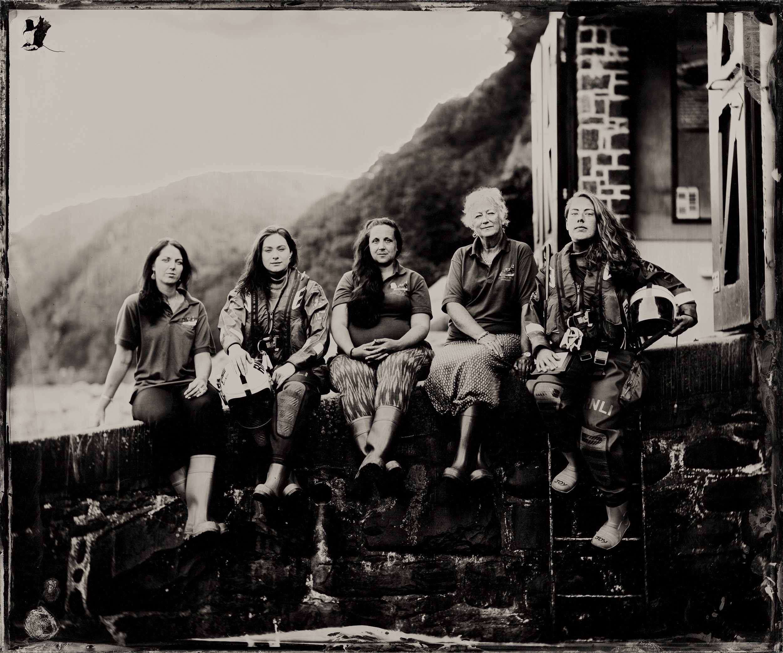
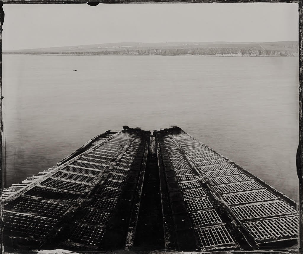
Travelling the coast in a decommissioned ambulance, photographer Jack Lowe is capturing the crew of all 238 RNLI lifeboat stations in the UK and Ireland on glass. At each lifeboat station, he captures three things: the boathouse view (of the waters they’re protecting), a portrait of every coxswain or senior helm and a group portrait of the volunteer crew.

In 2016 – a year into his project – Jack spoke to Joe Stebbing for issue five of Ernest, sharing an insight into his epic tour of the coast, the wet collodion process and his mobile darkroom, a decommissioned ambulance named Neena. Scroll down to read the original article and to find out how the project is going, five years on.


Jack Lowe has put a successful career on the line to embark on a self-funded project to photograph the crew of 238 RNLI lifeboat stations in the UK and Ireland using a Victorian method called wet plate collodion.

The technique is unapologetically analogue, but far from simple. Chemicals are applied to glass, whichis then exposed to light through the lens of his 110-year- old camera and developed in his mobile darkroom, Neena. There is no post-production, and adjustments are made for the slightest change of conditions on the quayside. A single photograph, or plate, can take more than an hour to prepare, compose and ‘make’.

As the plate is developed under the red glow of Neena’s safelights, the reason for the project and his choice of method becomes clear. The plates capture stunning levels of detail and depth, and yet so much more – a plate captures a story and a moment in time, reflected in light and shadow on the sea-weathered faces of its subjects.

JS: How did this project come about?

JL: Let’s call it a midlife correction. I’d reached a point in my life where I had to answer a question: “Do I want to spend the rest of my working days in front of computer?” The answer was an emphatic “No”. So I came up with the Lifeboat Station Project – a combination of my love of photography, the sea and the RNLI.

JS: Why photograph lifeboat crews?

JL: The RNLI strikes a chord for me on many levels.These crew members are volunteers, risking their own lives to save others at sea.They’re embedded in their communities – they might also be fishermen, farmers or teachers. For a rescue organisation to rely on donations and the goodwill of its volunteers is really quite special.

RNLI Minehead helmsmen


JS: Why use the wet plate collodion method?

JL: With this process, I’m making something irreproducible and uneditable.That plate of glass was in the camera, at that location, at that time, and becomes a completely unique photograph. I love that.

JS: Tell us about Neena – she sounds awesome.

JL: Neena is a decommissioned NHS ambulance, hence the name – get it? Built on a Ford Transit chassis, she has a spacious saloon in the back, which I’ve converted into a darkroom. She has two sets of LED lighting (one white one deep red), a fold-down step, extraction fans and she even has an intercom. Basically, yes, she is awesome.

JS: What is the process from lens to finished plate?

JL: First, I pour a chemical called collodion onto the centre of a piece of polished glass. I direct the liquid to each corner of the plate – this is called flowing the plate. The collodion needs to reach an optimum set point (before it starts to dry) so I can place it in a light-tight box containing silver nitrate. Here, a chemical reaction takes place, which makes the plate light-sensitive.

After three minutes, I switch on the red light for darkroom conditions. I draw the plate out of the silver nitrate and place it into a holder designed to fit on the back of the camera. Once loaded, I carry it from Neena to the camera – bear in mind that might mean marching 250m along a pier! I fit the plate holder onto the back of the camera, make the exposure, then take the holder back to Neena.There, I pour developer onto the plate and the image appears within seconds as a negative.

Once development has been halted with water, I open the door for the truly magical part: I pour fixer onto the plate.The ‘oohs’ and ‘aahs’, and even tears, from the crew come thick and fast as the plate transforms from negative to positive before our eyes.

The process produces a 12x10in ambrotype – a positive photograph on a plate of glass.

Five women of RNLI Clovelly, Devon


JS: Victorian photographs of sea faring folk seem to offer a true glimpse of the subjects’ character – do you see this emerging in your photographs?

JL: Yes, definitely.The photographs become a facet of the humility and generosity that exist within coastal communities and these lifeboat crews.

I’ve been most struck by the coxswains. Many have held their position for years – some are even the second or third generation.They have a calmness about them that can really take you aback.This reflects really well in the photographs – they seem to have an exceptional talent for standing still during the long exposures!

JS: What will be the outcome of this project?

JL: Eventually, this will form a book and an exhibition of over 700 photographs documenting the RNLI. I hope it will be a worthwhile legacy.

We spoke to Jack for issue five of Ernest (2016), when he was one year into his project. Since then, his journey has unfolded in unexpected and remarkable ways. Five years and 150 lifeboat stations in, Jack’s coastal travels came to an abrupt pause when social distancing restrictions were announced in March 2020. Taking the opportunity to reevaluate his project, Jack built an independent membership platform called The LSP Society, then went on to develop an app for iOS and Android where members can connect, access extra films, audio, blog posts and online talks, while helping Jack to see this historic odyssey through to completion.

Jack has kindly donated 15 sets of limited edition postcards and five limited edition prints of Longhope Slipway to our Collector’s Edition crowdfunding campaign. You can pick up one of these sets and prints on our campaign page, or you can browse the entire collection on the Lifeboat Station Project website.